Inquiry
WhatApp
Email
wanggan@cdwgkj.com
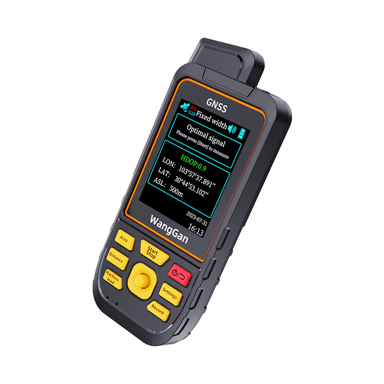
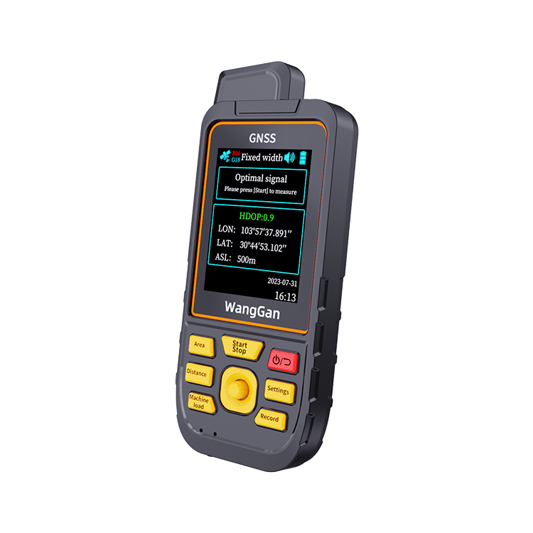
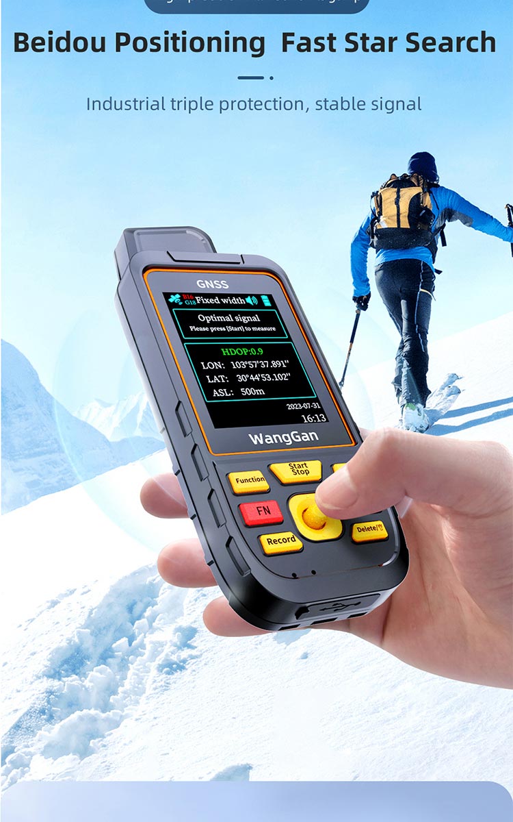
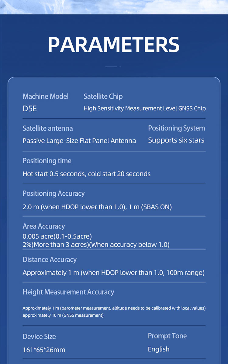
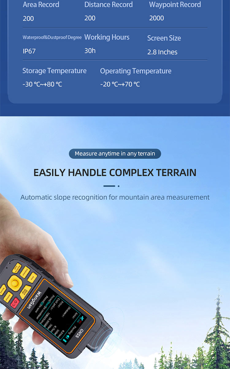
| {{item.title}} | {{item.parameter}} |